
SACRAMENTO, Calif. — 5:05 p.m. update:
Nevada County issued an evacuation warning ahead of the bomb cyclone and atmospheric rivers that are expected to arrive on Sunday morning.
The county issued the warnings for zones NCO-E102-A, NCO-E050-A, and NCO-E103A. They are saying flash potential flood and debris flow could cause hazardous conditions.
Original story:
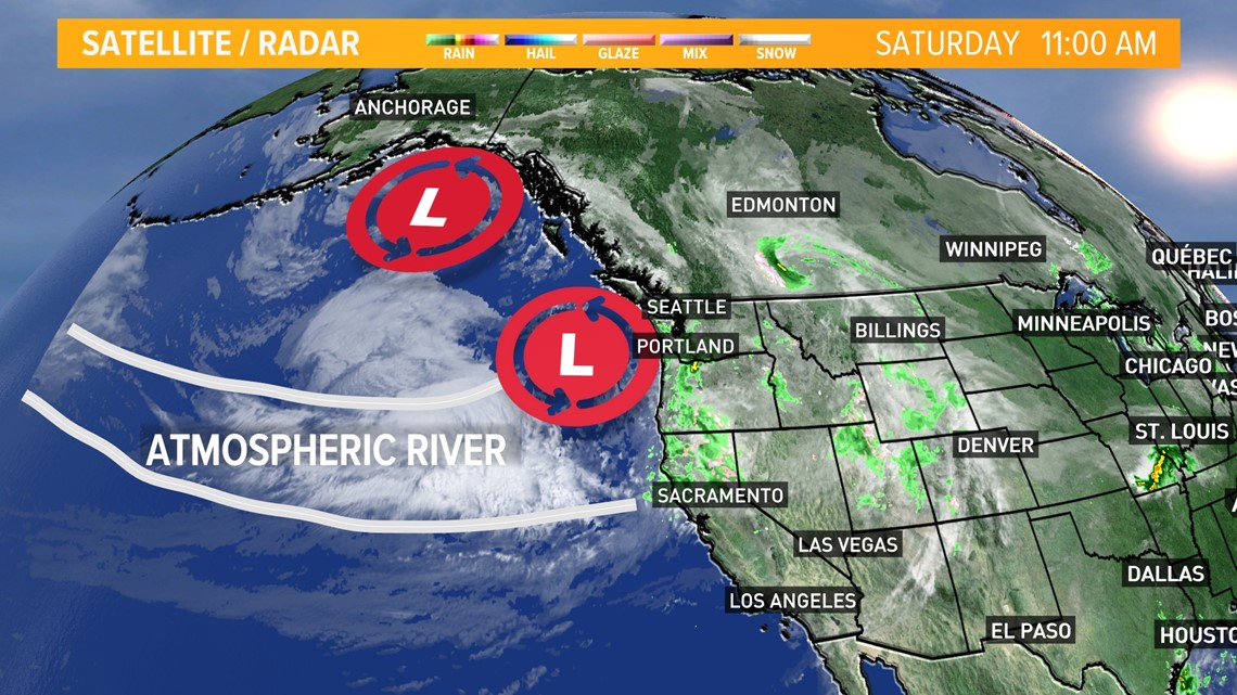
A bomb cyclone is defined as a weather event dropping 24 millibars in pressure over 24 hours. And it's approaching the Pacific Northwest late Saturday.
It’s strength and frontal boundary will tap into an atmospheric river containing massive amounts of moisture. According to the Centers for Western Weather and Water Extremes [CW3E], these atmospheric rivers can hold as much water as 15 times the flow of the mouth of the Mississippi River.

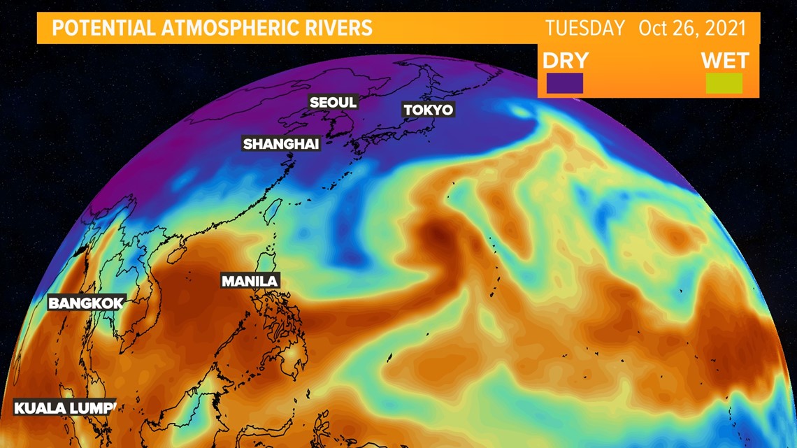
Marty Ralph, director with CW3E, says there can be as many as four atmospheric rivers at one time in the northern hemisphere.
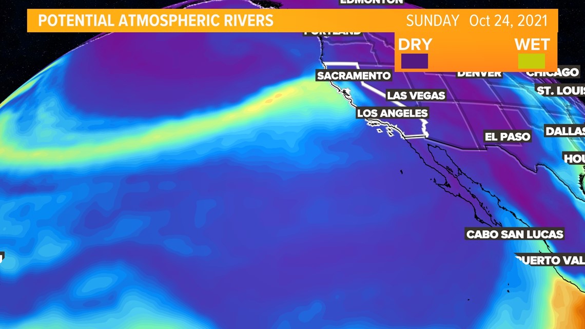
Although the western US is more familiar with the atmospheric river known as the “Pineapple Express,” a common area of origin for atmospheric rivers in early fall is near Indonesia. These early atmospheric rivers Northern California has faced this October have all originated near the South China Sea.

The long journey over the Pacific pulls the plume of moisture into a long narrow band. As of late, these bands have been pulled into several low pressure systems, causing rainfall over Northern California and the Pacific Northwest.

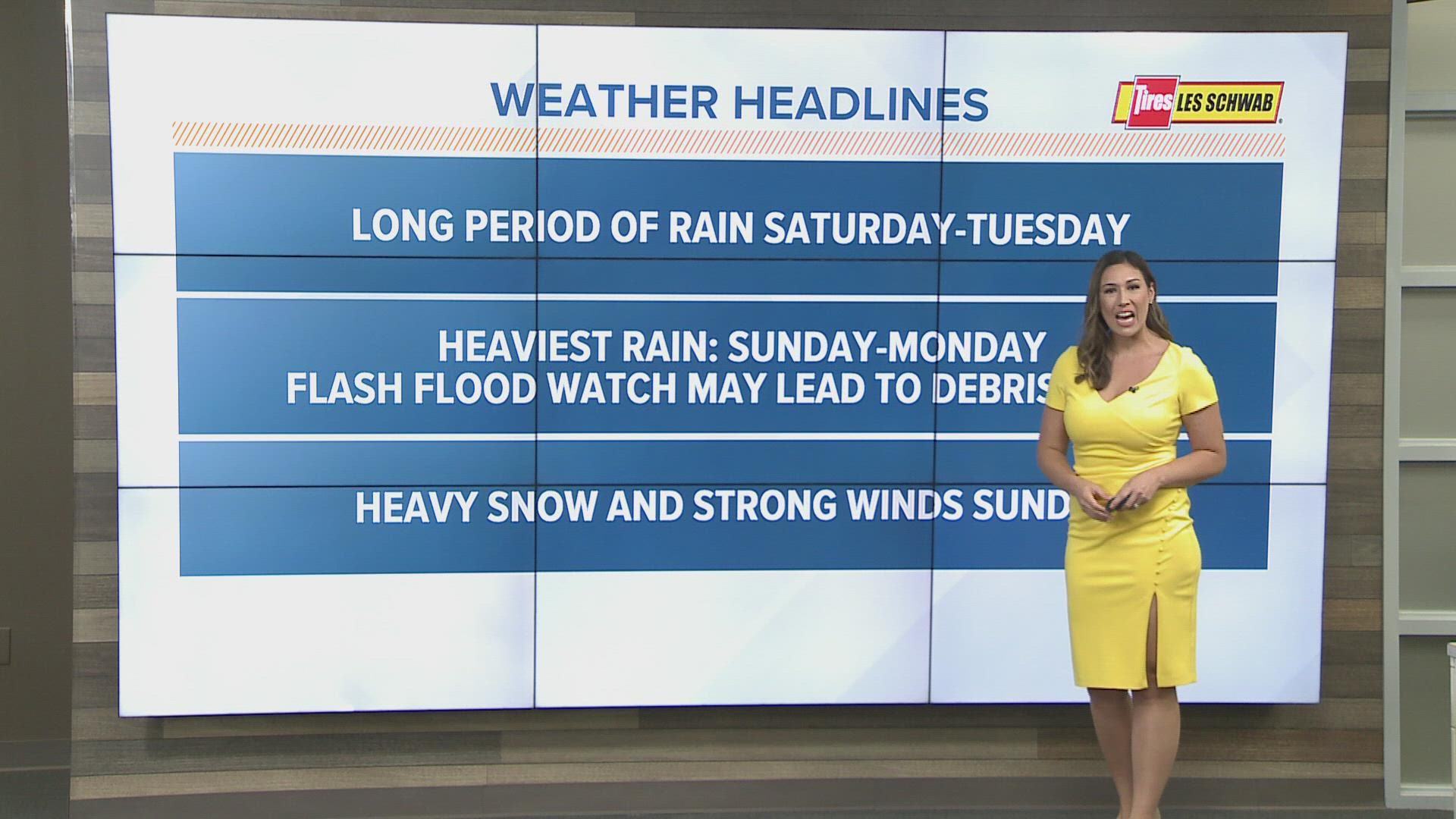
From Saturday night through Monday morning, heavy rain will cause concerns for flooding.
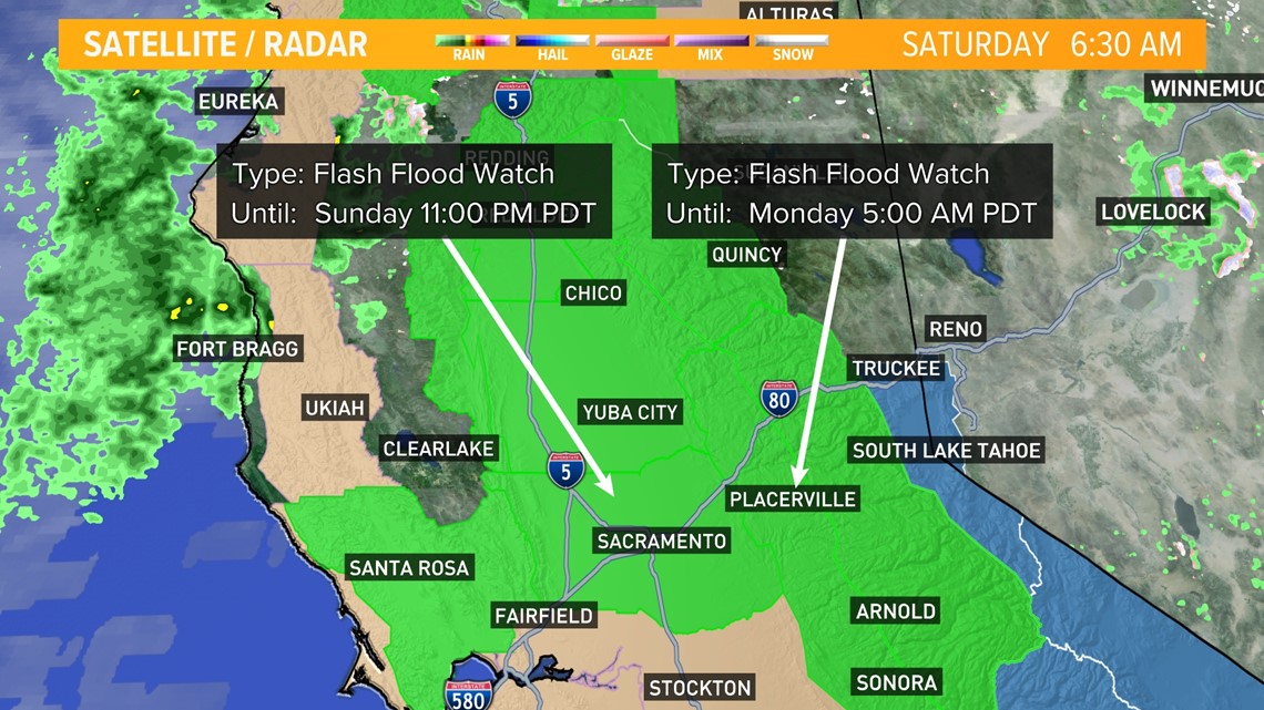
A Flash Flood Watch takes effect Sunday at 5 a.m. and lasting through either 11 p.m. Sunday for the Valley, or 5 a.m. Monday for the Southern Foothills. Up to half an inch of rain could fall per hour Sunday.

This system is expected to bring in anywhere from 2 - 6 inches of rain for the Valley, with some computer models showing closer to 5.30 inches in Sacramento.
If Sacramento gets close to those projections, it will be close to reaching the amount of rain received for the entire 2020-2021 water year.
Oct. 1, 2020 – Sept. 30, 2021 recorded only 6.61 inches of rainfall for the South Sacramento area at the Sacramento Executive Airport. Downtown Sacramento received 7.87 inches of rainfall for the same water year.
Flash flooding to urban areas and small streams is expected. Debris flows near burn scars are also a concern. The Yolo and Solano County areas where the LNU Complex Fire and Hennessey Fire burned will be areas to watch due to the intense rainfall and possible mudslides.
Rain isn’t the only concern.
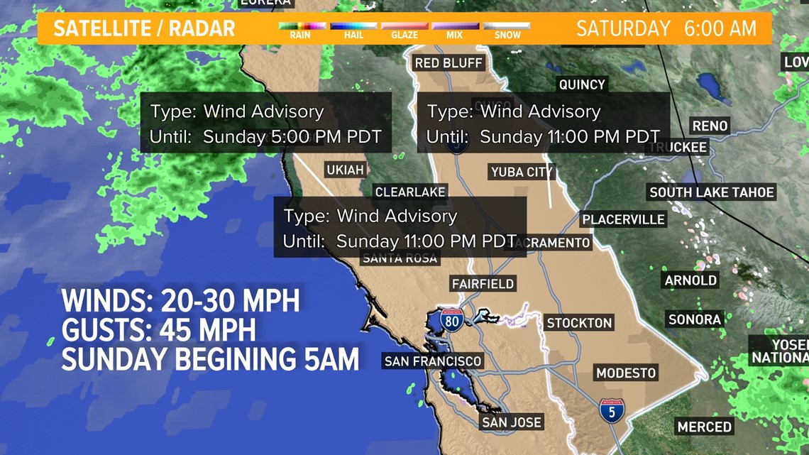
A wind Advisory will be in effect from 5 a.m. through 11 p.m. Sunday for 20-30 mph winds, with gusts up to 45 mph in the Valley.

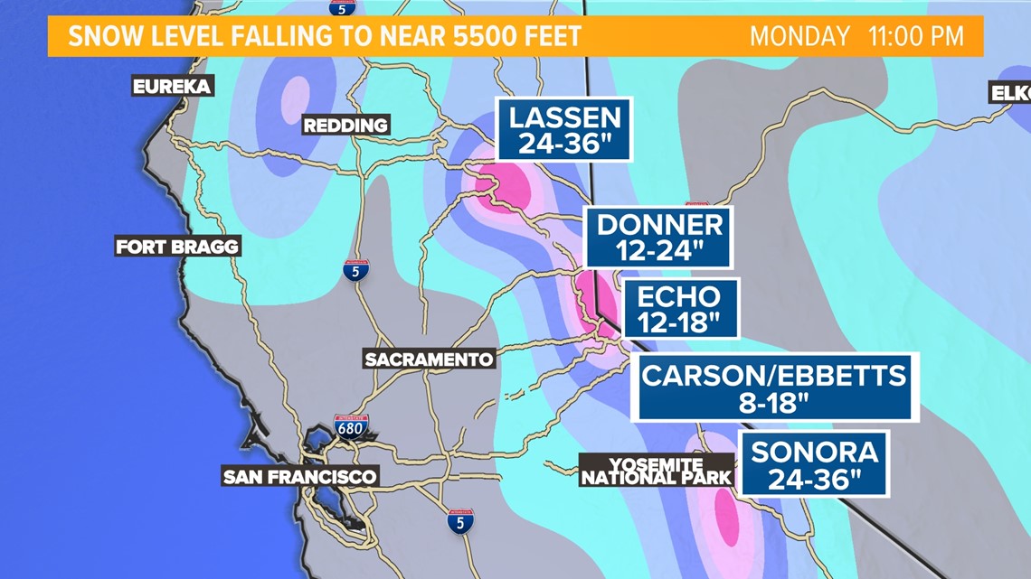
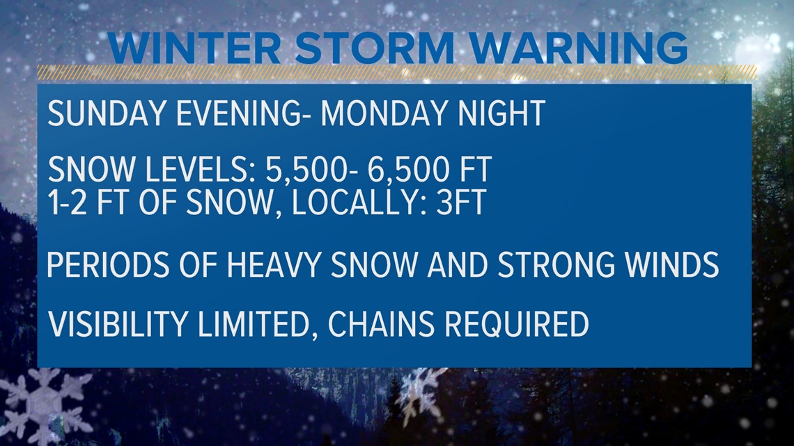
A Winter Storm Warning will go into effect at 11 p.m. Sunday and remain in effect through 11 p.m. Monday. Snowfall totals will range from 8 to 24” at 6000 feet with up to 1 to 3 feet at and above 8000 feet.
Visibility will be limited, especially overnight as strong winds and blowing snow will make it hard to see. Chains are expected to be required over the passes. In the event the roads are too bad to drive on, even with 4-wheel drive or chains, make sure you have enough blankets, food, and warm clothing to sustain if you have to pull over.

Visibility will be limited as strong winds and blowing snow will make it hard to see. Chains are expected to be required over the passes. In the event the roads are too bad to drive on, even with 4-wheel drive or chains, make sure you have enough blankets, food, and warm clothing to sustain if you have to pull over.

As the sun moves in Monday afternoon, chances of thunderstorms will arrive.
A slight chance of showers is possible Tuesday morning, with sunshine and cooler temperatures rounding out the work week.
ABC10: Watch, Download, Read


Watch more from ABC10
What is an Atmospheric River?