News
Deer Valley & PCMR report a foot of snow
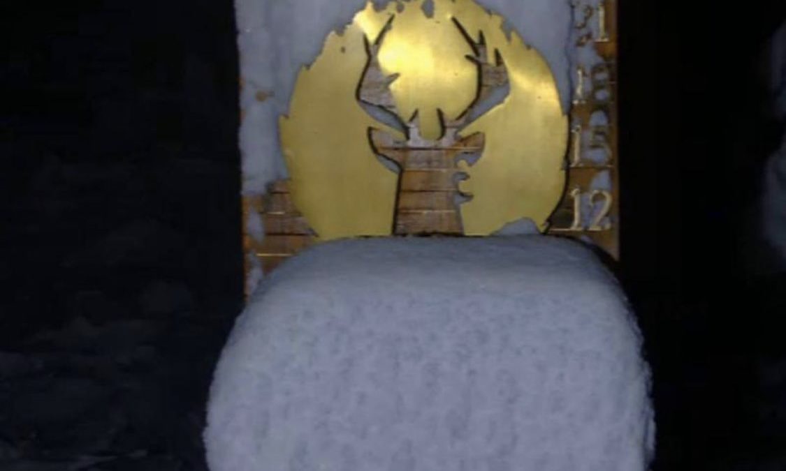
12 inches of fresh powder at Deer Valley on Tuesday morning. Photo: Deer Valley Resort
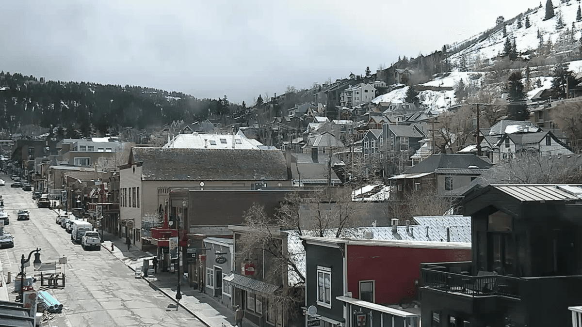
PARK CITY, Utah. — Park City got its first taste of snow on Monday night, as did the rest of Utah.
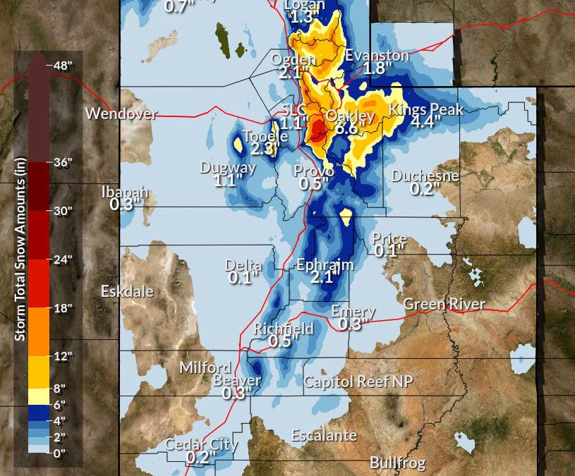
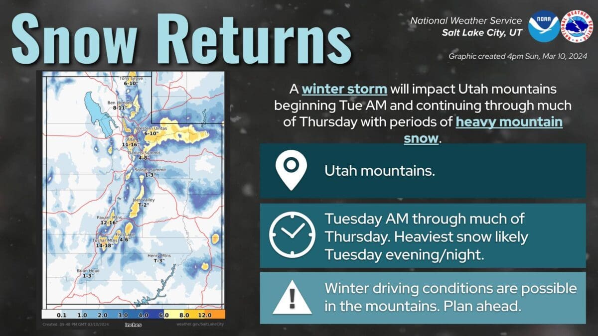
Another big storm impacting Utah this morning:
❄️11.5″ Logan
❄️11.0″ Solitude
❄️7″ Cedar City
❄️4″ Enoch
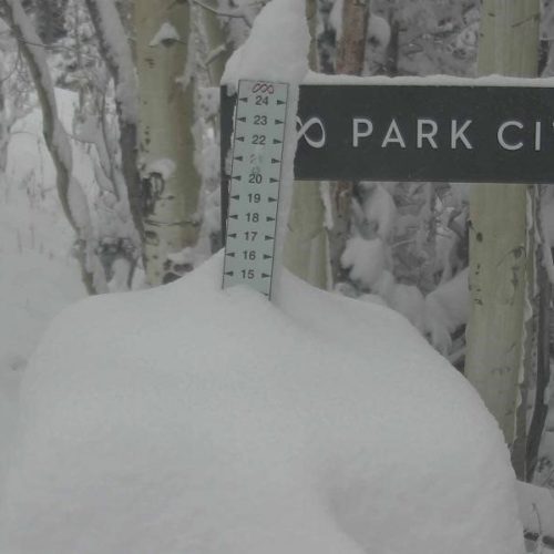
❄️3.3″ Park City
❄️2.7″ Newcastle
❄️1.8″ Oakley
❄️1.5″ Oak City
❄️1.0″ KanabMore reports in the link! #utwx https://t.co/hTJF8FYp8c
— NWS Salt Lake City (@NWSSaltLakeCity) October 12, 2021
The National Weather Service (NWS) is projecting more snow for the Park City area, on and off for the next few days.
Future forecast:
Today — Snow likely, mainly after 9 am. Mostly cloudy, with a high near 34. Northwest wind 11 to 13 mph. Chance of precipitation is 70%. Total daytime snow accumulation of less than one inch possible.
Tuesday Night — Snow, mainly before midnight. Low around 23. West wind 11 to 13 mph. Chance of precipitation is 80%. New snow accumulation of less than a half-inch possible.
Wednesday — A 20 percent chance of snow showers after noon. Partly sunny, with a high near 31. West southwest wind 7 to 10 mph.
Wednesday Night — Snow showers likely, mainly after midnight. Mostly cloudy, with a low around 25. West wind around 7 mph. Chance of precipitation is 70%. New snow accumulation of less than one inch possible.
Thursday — Snow showers likely, mainly before noon. Mostly cloudy, with a high near 28. West wind 8 to 11 mph. Chance of precipitation is 60%. New snow accumulation of 1 to 2 inches possible.
Thursday Night — Partly cloudy, with a low around 19.
Friday — Sunny, with a high near 35.
Friday Night — Mostly clear, with a low around 26.
View this post on Instagram
TownLift

1068 W Shoreline Dr
Layton, UT 840413137 East George White Road
Moab, UT 845327948 Red Tail Court
Park City, UT 840604536 N Painted Sky Drive
St. George, UT 847702600 N 1200 West, Suite 6
Lehi, UT 840437566 E Ponderosa Dr
Huntsville, UT 84317Talk of the Town


Park City Jobs
Summer Concert Staff, Park City Institute
Today Contractor $25.00 - $35.00 hourly
Office Administrator, Park City Soccer Club
2 days ago Part time $21.00 - $23.00 hourly

Community Liaison & Administrative Assistant to the General Manager, K&K Property Management
15 days ago Full time $20.00 - $23.00 hourly

Full-time paint retailer at Park City Paint, Park City Paint
17 days ago Full time $20.00 - $24.00 hourly

Park City Gardens is hiring for the summer!, Garden Cafe at Park City Gardens
23 days ago Seasonal $17.00 - $22.00 hourly
You May Also Like
You must be logged in to post a comment.