


Latest Forecast From Storm Team 4
What to Know
- Isolated severe weather threatens the tri-state area again Tuesday with thunderstorms and damaging winds possible
- Flash flooding is not expected with these storms, which could fire up later in the afternoon and evening hours mainly in NYC and spots south of the city
- Tuesday's temperatures remain in the mid-70s but an approaching cold front will send them into the 60s for the rest of the workweek
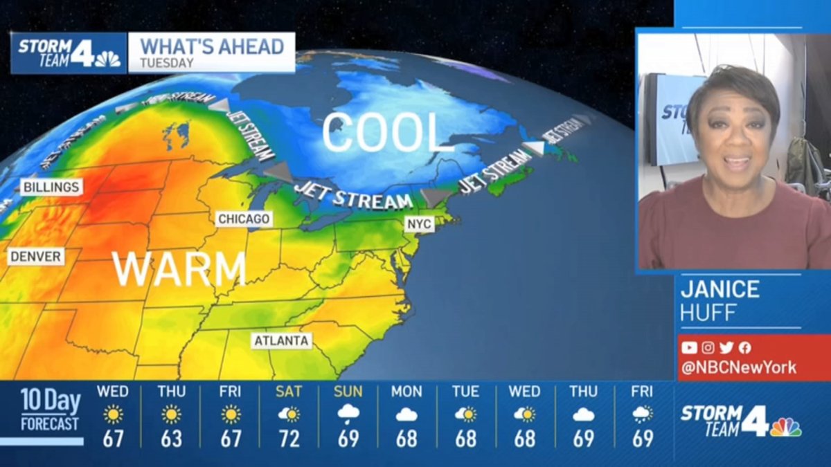
Isolated severe weather threatened the tri-state area again Tuesday with thunderstorms and damaging winds possible ahead of a cold front that will send temperatures into the 60s through the end of the workweek.
Some showers emerged early in the day north and west of the city and became more scattered by midday, with rain overspreading parts of New York City, accompanied by thunderous booms, just before lunchtime. They tapered off.
The stronger storms that were possible for areas from New York City south never really arrived, instead just more isolated storms moved through, with none packing much of a punch.
Get Tri-state area news and weather forecasts to your inbox. Sign up for NBC New York newsletters.
Check the latest severe weather alerts for your neighborhood here.
Cooler, drier air pours in behind the front late Tuesday into Wednesday, which will keep temperatures in the 60s for most. Central Park hasn't seen highs in the 60s since July 3, as it will definitely feel like fall for the next few days. Highs will remain below average for at least the end of the workweek.
The next 10 days look to be mostly dry, with temperatures remaining seasonable in the upper 60s.
Weather Stories


Track any approaching storms using our interactive radar below.

