


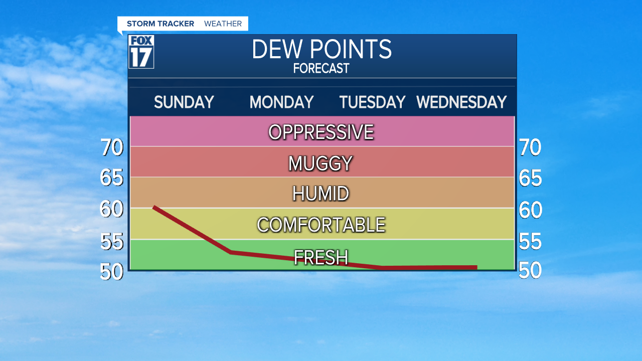
WEST MICHIGAN - After a week long forecast of high humidity/high dew point temperatures and readings in the upper 80s to around 90, we will finally begin breaking both the heat and humidity this week. Starting today, drier, more comfortable, less humid air will gradually filter in through the day. Dew point temperatures, a measure of moisture in the air, will go from low/mid 60s into the lower 50s by this evening. It will still be warm with highs in the middle 80s, but it will also become more comfortable by this evening. See dew point temperature forecast below.
An upper level disturbance will thicken our clouds by late evening and overnight and we may see a few rain showers, perhaps a rumble of thunder, mainly from Grand Rapids to the north and east. Locations south and west of Grand Rapids may just experience a few sprinkles or some residual cloud cover. These clouds and shower chances will linger into early Monday morning, otherwise skies will become mostly sunny to partly cloudy through the remainder of the day. See our forecast model image below, valid for 6 A.M. Monday.

Canadian high pressure building into the Great Lakes for Tuesday and Wednesday will produce a sharply cooler, drier, more comfortable refreshing airmass on those days with highs in the mid/upper 70s. Anyone with outdoor plans on those days, including Thursday, may want to take advantage of cutting the lawn, roofing a house, or perhaps some extended gardening with the dry conditions. See map below valid for Tuesday at 6 P.M.. Note Canadian high pressure to the north.

Our next widespread chance of showers/storms arrives on Friday. Get the complete West Michigan forecast at www.fox17online.com/weather
