Several roads flooded, some reopened after heavy rain
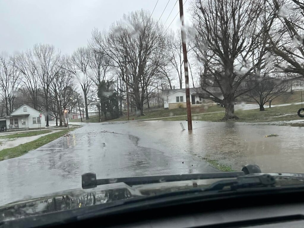
(KBSI) – Drivers are urged to be on alert. If you encounter a flooded roadway, please take note of the specific location using a mile marker, address, nearby crossroad, or other landmark and report it to your local 911 call center. Remember, Turn Around – Don’t Drown.
Missouri
The Missouri Department of Transportation reports several roads in southeast Missouri to be closed by flooding after head rains Thursday night and Friday morning. Check the MoDOT Traveler Information Map for the most up-to-date information.
Bollinger County
- Route H southbound and northbound closed due to flooding.
Cape Girardeau County
- Route P southbound and northbound closed due to flooding.
Ripley County
- Route K closed due to flooding.
Stoddard County
- Route K eastbound is closed due to flooding.
- Route T is closed due to flooding.
Illinois
Drivers in Illinois can check GettingAroundIllinois.com for traveler information.
Kentucky
The Kentucky Transportation Cabinet reports several roads in western Kentucky with water over them.
Ballard County
- U.S. 62 has normal traffic flow at the 1 to 2mm at Lovelaceville
Calloway County
- North 10th St will be blocked between Chestnut St and Payne St due to a tree on a power line. Please use an alternate route, according to the Murray Police Department.
Carlisle County
- U.S. 62 is closed at the 4 to 6mm in West Fork Creek Bottoms just West of the KY 121 4-Way Stop with barricades posted – KYTC personnel on site monitoring
- U.S. 62 is open at the 10mm in the Wilson Creek area between Cunningham and Lovelaceville
Crittenden County
- KY 855 is closed at the 5mm North of Frances at Doan Springs Creek between KY 70 and U.S. 60 – Signs Posted
- KY 902 is open at the 5mm in the Dry Fork Creek area near the Crittenden-Caldwell County Line between Dycusburg and Fredonia
- KY 91 at 15.7mm where the Cave-in-Rock Ferry is closed due to high winds
Fulton County
- KY 94 is closed at the 7 to 11mm in the Lower Bottom “Dip” Area between KY 311 and KY 1099 – Signs Posted
- KY 94 is closed at the 23-26mm in Willingham Bottom between KY 1907 and KY 1125 – Signs Posted
- KY 1907 has Water Over Road signs posted between KY 94 and KY 781 (All)
The Dorena-Hickman Ferry is closed due to high winds – Service to resume Saturday morning
Graves County
- U.S. 45 – closed at the 0 to 1mm at the Graves-Hickman County Line near Water Valley
- Purchase Parkway has water on the passing lanes at the 9.8mm between Fulton and Wingo where a branch of Bayou de Chien runs along the roadway – KYTC personnel monitoring
- KY 58 is closed at the 0 to 1mm at the KY 1283 intersection near the Graves-Hickman County Line
- The Graves County crew responded to about 25 trees down during the day
Hickman County
- KY 307 is closed at the 13 to 14mm in the Obion Creek area between KY 703 and KY KY 1748 – Signs Posted
- KY 58 is closed at the 7 to 8mm between KY 1540 and KY 1475 in the Cane Creek area – Signs Posted
- KY 80 is closed at the 2 to 3mm between KY 123 and the Hickman-Carlisle Co. Line – Signs Posted
- KY 2206/Spring Hill Rd is closed at the 0 to 1mm north of KY 703 near Cane Creek Bridge – Signs Posted
- KY 123 is closed at the 14 to 16mm in the Hailwell Corner Area Near Obion Creek Bridge – Signs posted
- U.S. 51 is closed at the 10 to 13mm north of Clinton between KY 1540 and KY 288 and closed at the 2 to 3mm south of Clintonn between KY 1529 and KY 1070
Livingston County
- KY 453/Iuka Rd has Water Over Road signs posted at the 9mm just south of KY 1889/Heater Store Rd
- KY 937/Cutoff Rd has Water Over Road signs posted at the 2mm
- KY 1433/Cedar Grove Rd has Water Over Road signs posted at the 4 to 5mm between Lemon Landing Rd and Head Rd
- KY 133/Lola Road has Water Over Road signs posted at the 6 to 8 mm near Lick Skillet Road and Wright Road
- KY 135/Carrsville Rd has Water Over Road signs posted at 6mm near Peck Branch at the Qutermous Rd intersection
Lyon County
- KY 1943 is closed at the 3.4mm at the Skinframe Creek Bridge
- DOWNED TREES: The Lyon County crew is working on more than a dozen trees down in the southern part of the county.
McCracken County
- KY 1255/Bonds Road is closed at the 1 to 2mm just west of the KY 450/Oaks Rd intersection
- KY 994/Old Mayfield Road is open at 5.5 to 5.7mm at the KY 1410/Houser Road intersection
- KY 1410/Houser Road is open near Champion Creek from 3.2 to 3.7mm near the KY 994/Old Mayfield Road intersection
- KY 1565 is closed from the 4.6 to 6.3mm between U.S. 60 and KY 358 in West Paducah – Signs Posted
- KY 996 is open between KY 3520/Old U.S. 60 and KY 726/McKendree Church Road
- KY 3529/Maxon Road (South End) is open between U.S. 60 and KY 3520
- KY 131 has Water Over Road signs posted at the 0 to 1mm at the McCracken-Graves County Line
- KY 994/Old Mayfield Rd is closed near the KY 348 intersection due to tornado damage and utility work
- KY 348/Hardmoney Rd is closed between KY 994/Old Mayfield Road and KY 1954/Husbands Road due to tornado damage and utility work east of Fremont
Marshall County
- KY 1949/Wadesboro Road is closed at the 7 to 9 mile marker near the I-69 Tunnel – Signs Posted
- KY 1462/Benton-Birmingham Rd is closed at the 0 to 2mm at the Clarks River Bridge- Signs Posted
- KY 795/Scale Road has Water Over the Road
McCracken County
- KYTC District 1 crews have been working with emergency management, utility crews, and law enforcement to clear roadways in the Fremont area of McCracken County to provide emergency access. Drivers are advised to use caution and be alert for rising floodwaters through the afternoon.