Winter storm warnings have been issued. Snow will arrive after 3 AM.


Updated: 11:00 p.m. Mar. 24, 2023
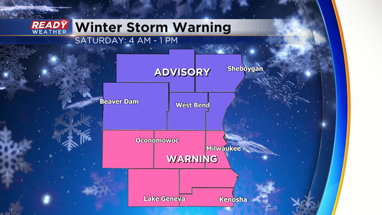
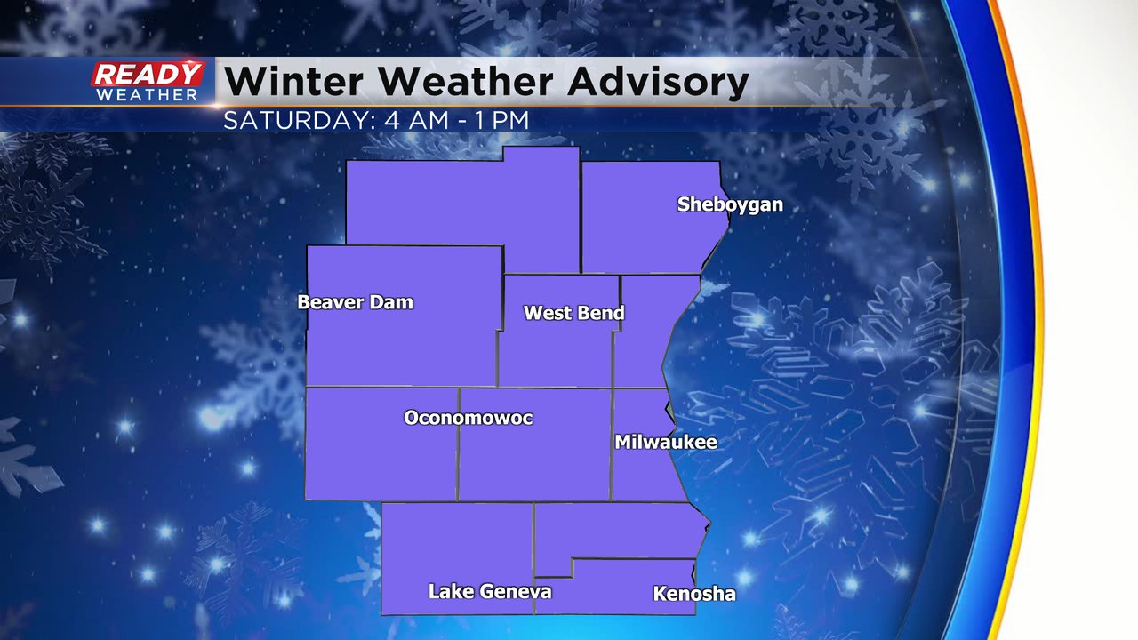
A winter storm warning has been issued for Milwaukee, Racine, Kenosha, Walworth, Jefferson, and Waukesha counties. All of our other counties are under a winter weather advisory.
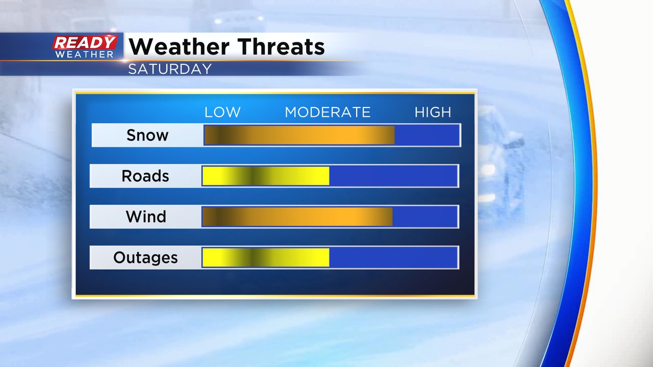
The new model runs continue to show very heavy snow through Saturday morning. This heavy wet snow will create power outages and very slushy roads. This is a very dangerous snow to shovel if you aren't in good shape, so please take care.
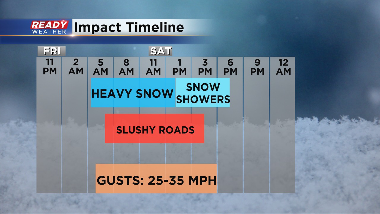
The most impactful timeframe is 4 am until Noon. The majority of the accumulation will occur there. Slushy roads and low visibility will create issues. The light snow should come to an end by 4 pm.
___________________________________________________________________________________________________________
Updated: 12:53 p.m. Mar. 24, 2023
Heavy wet snow is still on track for Saturday! While the storm isn't overly cold, brace for wind along with the snow.
Updated: 9:35 a.m. Mar. 24, 2023
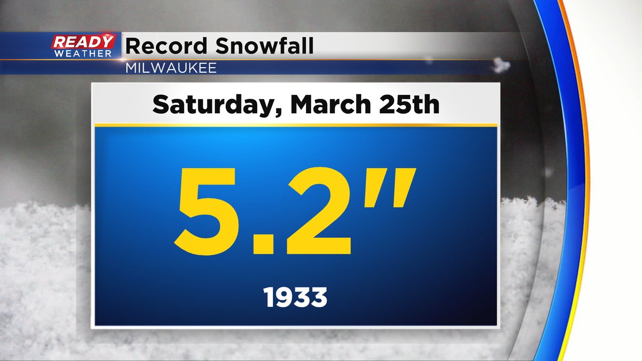
The record snowfall for Saturday, March 25th is 5.2" of snow. That record is on track to be broken if not shattered with this next storm.
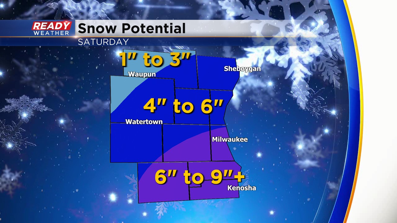
The forecast overall remains on track with heavy snow falling from midnight to noon on Saturday then coming to an end in the afternoon with dry conditions by Saturday evening. While parts of the area likely get over 6" of snowfall some of our northern and western communities may end up closer to a 1-3" or 2-4" range.
------
Posted: 5:40 a.m. Mar. 24, 2023
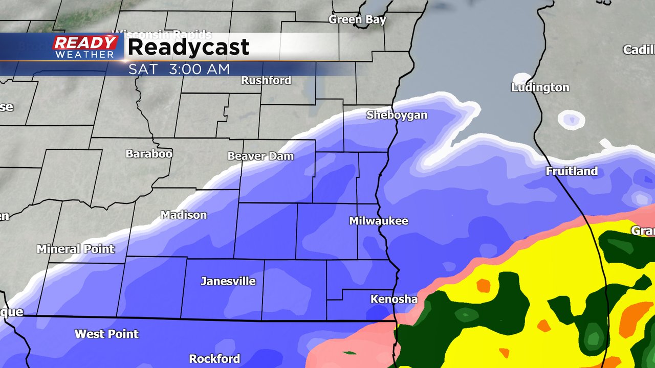
We may be in the first week of Spring but another big snow is on the way. This will be a very heavy and wet snow with overall mild temperatures during the duration of the event. After a nice Friday with some sunshine, snow arrives around midnight near the Illinois border and moves north with almost all of southeast Wisconsin seeing steady, heavy snow by 3 AM. Snow will continue throughout the morning, heavy at times, then lighten up a bit during the afternoon with most done with the snow by 5 PM.
A winter weather advisory has been issued for all of southeast Wisconsin for Saturday from 4 AM until 1 PM when snow is likely the heaviest. Some parts of our local area could be upgraded to a winter storm warning if snow totals go up.
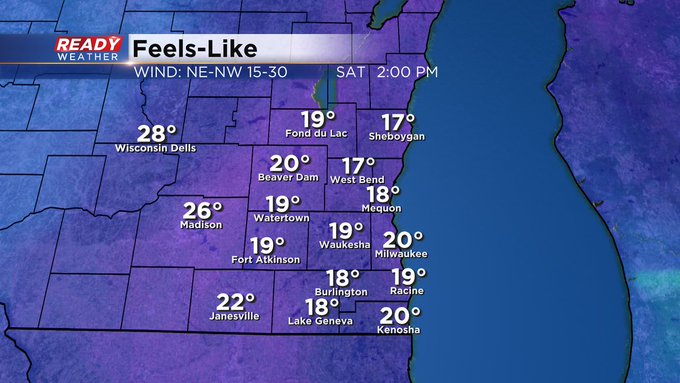
Even though temperatures will be mild and road temperatures fairly warm during the storm, the rate of snow will be great enough to cause the snow to accumulate even on the roadways. Expect slushy roads most of the day with the worst travel time during the morning. The wind will also be strong during this event with gusts to 35 mph. Last time we had a heavy wet snow like this one we had over 100,000 people without power. That is once again a possibility with heavy wet snow and lots of wind.
While weather models are consistent on all of southeast Wisconsin seeing accumulating snow, the area where the heaviest snow will happen is still in question depending on the exact track of the storm. Expect some changes to the map, but as of Friday morning most of southeast Wisconsin could see 6-10" of snowfall with 3-6" in some northern and western counties. There will likely be a sharp cutoff on snow totals with maybe only 25-50 miles separating those that just get a dusting with those that see 6".

Download the CBS 58 Ready Weather app to track the spring snowfall.