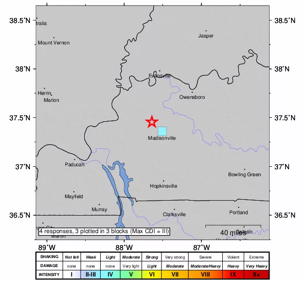
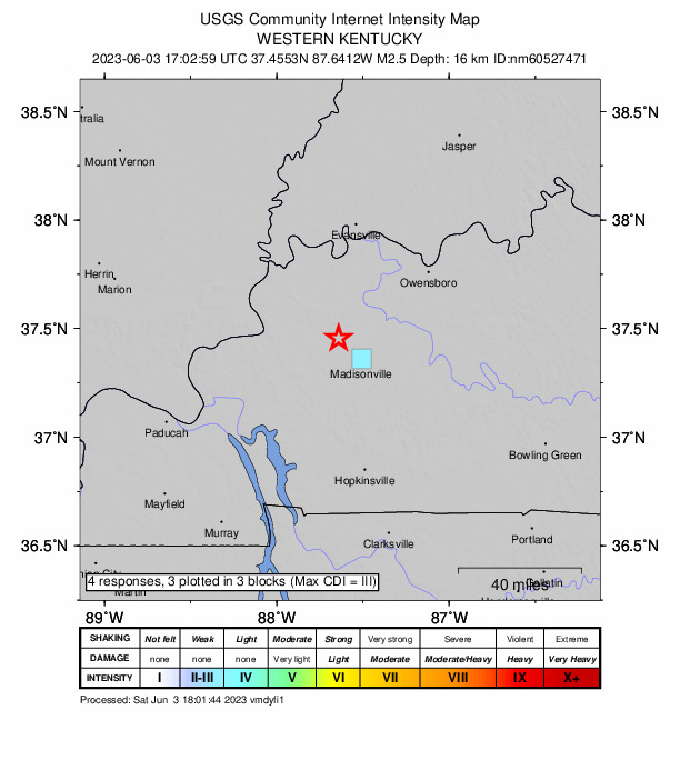
An earthquake — the third this week — was reported in west Kentucky by the U.S. Geological Survey Saturday afternoon, this one northwest of Madisonville and seven kilometers north of Nebo.
According to the USGS, it registered at 2.5, and came from within 16 kilometers of the Earth’s surface.
Last Monday night, a pair of earthquakes similar to this location were pinpointed and felt. Around 9:45 PM, the first, a magnitude 3.0 was recorded in McLean County, near Calhoun, 19 miles southwest of Owensboro. Four minutes later and about five miles away, the second, a magnitude 2.4 quake was recorded in Hopkins County, 24 miles southwest of Owensboro.
Meteorologist Jason Lindsey notes all of this shifting came from the Rough Creek Fault System, which serves as the eastern-most extension and terminus of the New Madrid Fault.
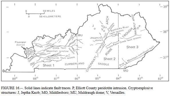
In a January 2001 report from the USGS’s Robert McDowell, he described west Kentucky as part of the “Illinois basin,” to include the Pennsylvanian coal field, the Rough Creek and Pennyrile fault systems, the Moorman syncline between those fault systems, and an Illinois-Kentucky fluorspar district near Paducah and the Ohio River.
The Rough Creek fault system is comprised of high-angle normal faults and less-common reverse faults, with strip mining of the coal fields indicating dip-slip movement and significant vertical movement through at least Early Permian times.