undefined
Posts
undefined
Followers
Dave Murray's extended winter forecast
By Michael Calhoun,
13 hours ago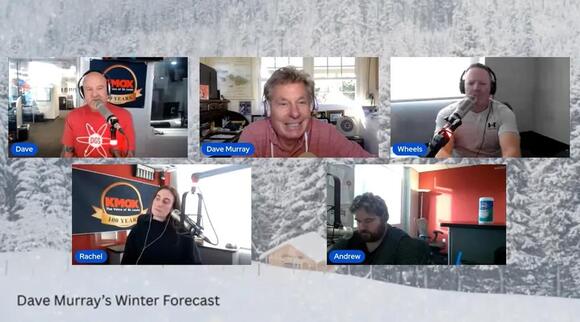
DAVE MURRAY’S EXCLUSIVE WINTER FORECAST FOR ST. LOUIS...2026-2027:.The Fall season was an interesting ride…most seasons are here in STL…El Nino was and continues to be a driving force…it is coming on a few months early…compared to a typical El Nino. The weirdest was the month of September…the hottest on record. This month created an optical illusion…that the Summer was really hot. It was not…Fall got off to a very hot start. In fact, the Summer was quite delightful, at least for Summer in STL.October was also a weird month…more big swings in temperatures and the changing of the seasons and November settled back into place..
Things that are important this Winter…Is there a correlation between El Nino and a very quiet hurricane season in the Gulf and the Atlantic? Yes this was El Nino driven…there seems to be a link…a link that points to cooler conditions in the beginning of Winter…a pattern already setting up.Also, the Pacific was super charged…the most active in the last 5 years and Hawaii was affected with three rare systems. Hawaii typically does not get hit by hurricanes because the water surrounding the Islands is cooler (not this season). And the heat driven ocean temps…due to El Nino creating monster, dangerous and damaging surf and tides along the southern Califonai coast…along with a blob of very warm water(not El Nino) hangs along the west coast, known as a marine heat wave. El Nino will fade but the marine heat wave(thermal expansion) could last 1-2 more years..
Winter is on the way..
The Winter forecast is always the king of the hill…the most interesting, popular, and always the toughest of the seasonal forecasts. So there may be great glories ahead but there are also the possibilities of great busts too. Long range forecasting is not easy. .
There are several keys to the Winter forecast this season...that’s always fun and no question this is a big time challenge...but that is always true with my long range seasonal forecasts..
The giant key about this Winter will be El Nino…the drum has been beating like a train coming down the track. But I’m sticking with the idea that El Nino (not a super El Nino)…that started very early in the Summer (weird) is already showing signs that it has reached its peak and is now starting to slowly calm down. Remember oceans are slow to give up their warmth or coolness. In contrast…the Blob of warmth is not going away and may be a player along the west coast for another year or two…resulting in higher than normal tides. Keeping ocean levels about 12 to 18 inches higher than normal. This does not sound like much…but add in King Tides, from the Winter full moons and strong surf…that 12 to 18 inches is a very, very big deal.
I know, I know…why all the talk of the Pacific Ocean temperatures…La Nina and El Nino and everything in-between are very important in long range forecasting…because it is all about ocean temperatures. The oceans, that make up 70 percent of the Earth’s surface, are the true weather driver around the globe..
Again…as I have said many, many times...don’t get sucked into the broad-brush of the La Nina or El Nino game… this has become so common…not all are the same…no matter how much certain people in meteorology, media and climate want to make the cause and effect…always the same...don’t put all your eggs in one basket…that’s not weather forecasting..
There are other items we have to keep in mind...There are about 20 factors that I look at and study when putting these long range forecasts together… And in my book they all have some weight in the final forecast...and this is just not a quick look...this is a process that goes on every day...consistency and continuity is how I was taught forecasting…it has never let me down. A forgotten major element, because of the model parade (worship) and AI..On to the factors that are in play… Here’s a short list...can’t give all my trade secrets away:).
- The analogs...looking back at past weather and then moving forward to compare what's going on in our atmosphere now… The analogs are one of the most important things in my long range forecast. Have to look back on the hurricane season and look back on the month of October…Years of interest… 1982-83, 1986-87, 1997-98 and 2015-16…but this is a good time to bring up the idea that this is a very weird El Nino…ie: early start, negative PDO, the early stratospheric warming event and the peak hurricane season in the Atlantic and the powerhouse season in the Pacific. So the analogs may not be a huge help for this Winter season…this set up is not common at all.
- The solar cycle… The Sun is now in the descending phase of Solar Cycle 25 (moving toward the next solar minimum expected around 2030.
- World wide volcanoes… Not just the activity but the locations...critical in a long range forecast….volcanoes continue to be active.
- Southern Oscillation (ENSO)
- Pacific Decadal Oscillation (PDO)
- Atlantic Multidecadal Oscillation (AMO)
- Indian Ocean Dipole (IOD)
- West Pacific Oscillation (WPO)
- North Atlantic Oscillation (NOA)
- Arctic Oscillation (AO)
- Scandinavia (SCAND)
- Quasi-Biennial (QBO)
- Solar Flux and geomagagnetic (Ap)
Strong El Niño events (1982–83, 1997–98, 2015–16) generally occurred with a positive or neutral PDO and without an early-season stratospheric disruption of this magnitude. The negative PDO tends to weaken or shift some of the classic North Pacific–North American teleconnections, while an early SSW can inject additional wave activity that either reinforces or interferes with the El Niño response depending on timing and wave structure.
So the tropical Pacific forcing is very strong, but the extratropical and Indian Ocean surroundings are not the usual companions. That makes the North American response less of a straightforward “textbook strong El Niño” pattern and more of a competition between the El Niño base.
.Okay…lets get to the details…The Winter season in STL..DECEMBER:.December Facts:December 1st…sunrise: 7:00…sunset: 4:40December 31st...sunrise: 7:19…sunset: 4:50Average high and low: 44.5/28.5…Records: 76(2021)/-16(1989)Average rainfall: 2.50”Average snowfall: 3.2”.DECEMBER DATES:The Full Moon…December 23 …The full Cold moonThe Winter Solstice…December 21stChristmas Day…December 25th. The major factors: *** Winter will get off to a fast and strong start…not your typical thinking in a strong El Nino pattern…but this is not your father’s El Nino plus other features ( a negative PDO) suggest something different and maybe unexpected.*** Also an early season sudden stratospheric warming event adds to my thinking here. So again, it is just not El Nino…one and done…wrap it up…no…no…no.*** As Winter sets in we will see some wild swings…much like the Fall season in the STL area.*** There is going to be lots of cold weather in Canada and Greenland… and a strong developing snow pack…this becomes the start of the highway of cold times. Not AC/DC’s Highway to Hell.*** I want to bring several shots of cold air in from the north…we will be on the edge of these pushes…but thinking close enough.*** Thinking when we add the month up...temperatures will be below average…not a lot below, but below.*** How about records...December records are intense...I don’t see any records…high or low.*** Moisture will be interesting… We always play with the atmospheric battle of the northern and the southern storm tracks...the northern track...the Alberta clipper flow and the southern track brings the tricky southwest storms… more concerns with the northern flow and the Alberta Clippers. The southern storm track will be close but for the most part too far south…but needs to be watched.*** So my thinking is rainfall and snowfall will be near average…December is not a big snow month (average 3.2 inches), but we all know it happens..The Christmas forecast.Of course this is the big one...another time to go way, way out on a limb and try to forecast a one day event… A tough thing to do in a long range forecast… Yes, the limb can break off at any time…and it has been known to happen… but that's the challenge in true forecasting…not model and AI worship.Some facts:- Probability: There is a 20% chance of a white Christmas in the St. Louis area in any given year.
- Recent Occurrences: The last time St. Louis officially had a white Christmas in 2022 (1 inch of snow). We were very close last Christmas…with a nearby southern storm.
- Average Snowfall: While snow does fall in St. Louis during winter (averaging 18-19 inches per season), most of it typically occurs in January and especially February.
- Definition: For it to be an "official" white Christmas, there must be at least one inch of snow on the ground by 6:00 a.m. on Christmas Day. The chance of measurable new snowfall on Christmas Day itself is even lower, around 13%
The best ever white Christmas (in my book) was on Christmas Eve of 2002…it was magical…starting to snow in the early evening and dropping 4 to 6 inches of wonderful snow…offically 5.8 inches.
.
So…lets go back to my thinking for Christmas…Winter will come on early and fast with an active northern storm track…snow bunnies you sense where I’m heading...drum roll please...this Christmas...2026…I’m expecting a WHITE Christmas in St. Louis...man, I can't believe I said that! This will not be a big storm system but thinking we could get an Alberta Clipper to come into play…so a shot at a marginal white Christmas.
Things to look for in December:***the great horned owls begin courting***check out the sky--easy to spot the winter constellation... orion*** the bald eagles start to arrive in good numbers
JANUARY:.January Facts:January 1st…sunrise: 7:19…sunset: 4:51January 31st...sunrise: 7:08…sunset: 5:22Average high and low: 40.4/23.8 Records: 77(1950)/-22(1884)Average rainfall: 2.59”Average snowfall: 5.7”.JANUARY DATES:New Years Day…January 1stThe Full Moon…January 22 …the full wolf moonMartin Luther King Day…January 18th. The major factors: .*** The first part of January will start out cold…left-over from my December ideas…then a huge flip takes place*** Deep cold air over Canada but in January it will struggle to release over the middle of the nation…the Great Lakes and the Northeast…yes, but missing us, for the most part.*** We should start the New Year off with a cold spell (if my December ideas come true) then the cold pattern relaxes and takes a break. But I don’t think this is the end of Winter cold.*** As a result, I’m thinking temperatures...will end up to be near average…only because of the early cold…if that does not take place…January may be well above average with temperatures. Always have to have a little wiggle room.*** How about the January thaw…well since I’m expecting okay Winter temps for the middle and end of the month…there should be a January thaw.*** As for records...again the powerful cold will be to our north and northeast and records in the heart of Winter are intense…January records will be hard to come by…no records…high or low.*** The core storm track for the early part of the month will keep the northern track alive…think of the Alberta clipper track idea…so some snow is possible. Then the southern track takes over…and it will get busy…could be very active but it may be too far south for us and as the cold air locks just to the north…any moisture we see should be mainly rain…but some ice and snow may also come into play.*** Moisture…rainfall will be near average and snowfall will be below average..Things to look for in January:.***look for the red-tailed hawks perched along highways...looking for food***watch for chickadees feeding up and down trees***Beavers begin breeding this month..
FEBRUARY:.February Facts:February 1st…sunrise: 7:07…sunset: 5:23February 28th...sunrise: 6:33…sunset: 5:54Average high and low: 45.8/27.6 Records: 85(1972)/-18(1905)Average rainfall: 2.23”Average snowfall: 4.3”.FEBRUARY DATES:The Full Moon…February 20 …the full snow moonValentine’s Day…February 14thPresident’s Day…February 15th. The major factors: . *** This is the Winter month that gets really funky, analogs no help, storm tracks all over the place, guidance and AI of little help. So a lot of stuff can be put in the trash and that makes for some very difficult forecasting times.*** The setup will allow building cold air over the Arctic and Canada to release over the middle of the nation…especially if we get the second late stratospheric warming event (think we will)…there will be 1 to 3 cold air intrusions from the north country.*** Let’s think cold for much of the month with below average temperatures… but no super deep cold (just cold), so not expecting any records.*** As for moisture… the northern storm track kicks back into gear and I think the southern storm track will be very active but the cold idea should keep it pushed well south and east. This could be a wild month for the south and the east coast.*** So we will be walking a very fine line…what’s new…the link between cold and southern moisture may be tough to come by…but it only takes one and will be watching very carefully.*** Let’s look for 2-3 clippers and maybe, just maybe, one southern system (the southern system has to link perfectly and the focus for snow in southern systems is typically on the backside of the low pressure).*** So rainfall will be below average…snowfall…February snowfall when it happens is typically a big deal…and though it only takes one storm system…thinking snowfall will be near average.*** For the Winter season(of course the snow season runs into early April)...but for the three months of Winter...thinking snowfall will be below average ...10-11 inches or less…(Average is 18-19 inches).Let’s not lose hope snow-bunnies…again it only takes one..Things to look for in February:.***red flower buds of the silver maple swell with the first warm spell***chickadees begin to sing--the first bird song of the year***look for robins returning in large flocks.Enjoy the Winter season...some love it...some hate it, but you have to admit the weather is always fun and interesting in the middle of the nation...it's the only weather we have! So let’s enjoy it. My Spring forecast will be out in mid to late February… seems like a long, long way off right now…it is! Any questions or comments…just let me know. Have a great holiday season everyone…be safe.
 Add to Preferred Sources
