undefined
Posts
undefined
Followers
Snow Chances Shift As Potential Nor’easter Approaches: Latest Update
By Joe Lombardi,
3 days ago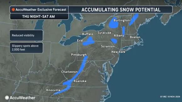
A potential Nor’easter could bring the season’s first snowfall to some Northeast communities, but the forecast is shifting as the system approaches.
The National Weather Service’s Weather Prediction Center says forecast models now favor a slightly faster storm with less precipitation. The threat of lower-elevation snow has decreased, while potentially disruptive mountain snow remains a concern.
The center expects low pressure to develop across the Ohio Valley around Wednesday, Nov. 11, then move off the Mid-Atlantic coast and strengthen Friday, Nov. 13. Small changes in its track could still alter snowfall and coastal impacts.
Rain should spread across the region Thursday, Nov. 12, becoming widespread that evening and overnight.
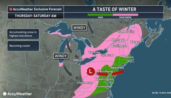
Pink marks potential rain and snow from Thursday, Nov. 12, through Saturday morning, Nov. 14. Accumulation is favored at the highest elevations.
AccuWeatherWet snow could mix in well inland Friday night into Saturday morning, Nov. 14. The office does not expect a mix for New York City, Long Island, most metropolitan northeastern New Jersey locations, or immediate coastal areas.
Even inland, snow depends on colder air arriving before precipitation ends. Parts of the coast also face possible minor flooding during Thursday’s and Friday’s high tides.
AccuWeather identifies the Poconos, Catskills, and Berkshires as mountain areas with snow potential. Its accumulation graphic highlights possible reduced visibility and slippery spots above 2,000 feet.
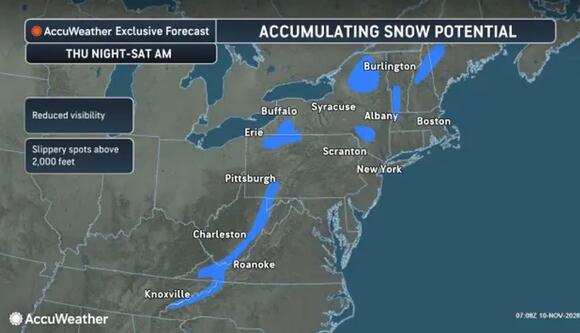
Accumulating snow could create slippery spots above 2,000 feet from Thursday night, Nov. 12, through Saturday morning, Nov. 14.
AccuWeather“Even in a perfect setup for November snow, which this is not, it is very difficult for snow to fall, let alone accumulate at low elevations along the I-95 corridor,” AccuWeather Senior Meteorologist Alex Sosnowski said. “Atlantic water temperatures are in the 40s, 50s, and 60s offshore of the Northeast, so any kind of breeze off the water will cause the air to be too warm.” AccuWeather
Rain returns to Maryland and northern Virginia Thursday. The Alleghenies could see accumulating snow beginning Thursday night and continuing Friday, according to the NWS Baltimore/Washington office.
Colder air and brisk winds follow into the weekend. AccuWeather’s broader outlook projects the season’s coldest air, with temperatures 5 to 15 degrees below historical averages across a broad portion of the East.
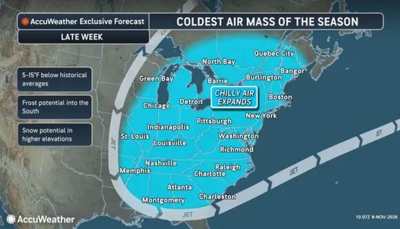
The season’s coldest air could arrive late this week, with temperatures 5 to 15 degrees below historical averages and frost potential extending into the South.
Snowfall totals and coastal wind strength remain uncertain.
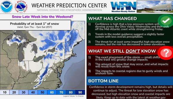
The NWS shows lower snow chances at lower elevations, while mountain snow remains possible from Thursday night, Nov. 12, through Saturday, Nov. 14.
AccuWeatherCheck back to Daily Voice for the latest updates.
 Add to Preferred Sources


