undefined
Posts
undefined
Followers
Weather Shift Follows Weekend Storm System: What To Expect
By Joe Lombardi,
2026-10-03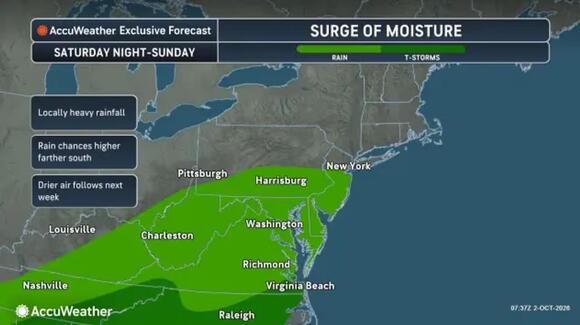
A fast-moving storm system will disrupt the Northeast’s weekend before a shift in the weather pattern brings a different concern early next week.
The National Weather Service forecasts sunshine for New York City and Boston on Saturday, Oct. 3, followed by rain chances on Sunday, Oct. 4, and a cooler turn by Tuesday, Oct. 6. Conditions will vary considerably between coastal cities and inland communities.
Saturday’s highs should reach around 70 degrees in New York City and the mid-60s in Boston. Farther south, Washington, DC, faces clouds and a chance of showers.
Rain becomes more widespread Sunday, Oct. 4. The NWS forecasts showers in Washington during the day, with rain likely in New York City mainly after 2 p.m. Boston’s chance of showers arrives Sunday night.
AccuWeather’s storm outlook places higher rain chances farther south, including Virginia, Maryland, and Pennsylvania. Its accompanying map shows wet weather extending toward New Jersey and the New York City area.
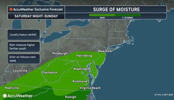
Rain spreads across parts of the Mid-Atlantic from Saturday night, Oct. 3, through Sunday, Oct. 4, with higher chances farther south and possible locally heavy rainfall.
AccuWeatherClearing follows Monday, Oct. 5. NWS forecasts call for highs around 70 degrees in New York City, Boston, and Washington, with westerly or northwesterly breezes.
The sharper cooldown arrives Tuesday, Oct. 6, when highs fall to around 60 degrees in Boston and the mid-60s in New York City and Washington.
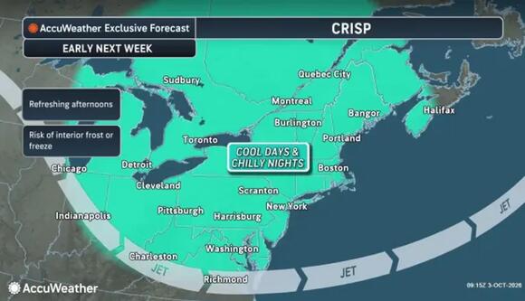
Cooler days and chilly nights settle across the Northeast early next week, with frost or freeze risks greatest in interior areas.
AccuWeatherThe greater concern comes Tuesday night into Wednesday, Oct. 7, particularly inland.
"By Tuesday night and early Wednesday morning, the risk of a frost or a freeze will expand eastward into the Appalachians and interior Northeast," AccuWeather Senior Meteorologist Brett Anderson added. "The highest risk of a killing freeze will be from the northern mountains in Pennsylvania to the Adirondacks of New York and the Green Mountains of Vermont."
AccuWeather’s frost map also highlights interior southern New England, including portions of Connecticut and Massachusetts. Sensitive plants may need covering or moving indoors.
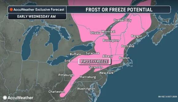
Frost or freezing temperatures could reach parts of the Appalachians and interior Northeast early Wednesday, Oct. 7. The shaded area indicates forecast potential, not an official frost or freeze warning.
AccuWeatherCoastal cities should stay warmer. NWS forecasts keep Tuesday night’s lows in the 40s in Boston, New York City, and Washington, followed by sunshine and modest warming Wednesday.
Check back to Daily Voice for the latest updates.
 Add to Preferred Sources

