Chicago weather: Tornado, thunderstorm warnings expire, widespread storm damage reported


CHICAGO (WLS) -- Nearly the entire Chicago area was under some type of severe weather warning or watch Friday night as a line of intense storms raced through the area, leaving damage and flooding in their wake.
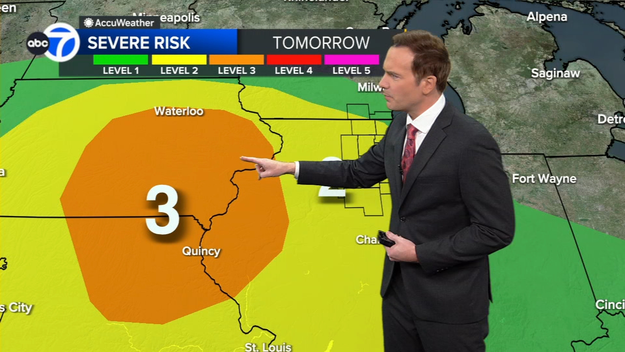
The National Weather Service warned of a "particularly dangerous situation" with the potential for intense tornadoes to develop across Iowa and Illinois Friday morning, a prediction which has largely come to pass. The NWS said the severe weather threat was officially over as of 10:35 p.m.
While earlier tornado and thunderstorm warnings have expired, a Wind Advisory remains in effect until 1 p.m. Saturday for Boone, Cook, DeKalb, DuPage, Will, Grundy, Kane, Kankakee, Kendall, LaSalle, Lake, Lee, Livingston, McHenry and Winnebago counties in Illinois, and Benton, Jasper, Lake, Newton, and Porter counties in Indiana.
Reports of damage in the large line of the storm's wake were widespread.
One person was killed and 28 people were injured when the roof collapsed at the Apollo Theatre in Belvidere during the severe weather outbreak.
READ MORE: Theater roof collapses in Belvidere, multiple injuries reported

ComEd said as of 9:45 p.m., 61,073 customers are without power. Crews are working to restore power as quickly as possible.
Air travel in Chicago is being affected by the severe weather. As of 9 p.m., Midway International Airport reported 129 flight cancellations and average delays of 33 minutes, while O'Hare International Airport reported 262 flight cancellations and average delays of 47 minutes. The Federal Aviation Administration issued ground delay has been extended until 11:59 p.m., with an average delay of 233 minutes due to thunderstorms.
Indiana State Police said four semis were blown over on Interstate 65 near the exits for Remington and Lowell. There are extensive closures on I-65 southbound, and drivers should avoid the area.
Illinois State Police said troopers responded to multiple overturned vehicles on Interstate 57 near Rantoul in Champaign County downstate, which were blown over by strong winds from the storms. Three people were taken to a local hospital with non-life threatening injuries, state police said. There are also downed power lines across the interstate. I-57 will be shut down for several hours for cleanup, and traffic is being diverted at northbound exit 250 and southbound exit 261. Drivers should avoid the area.
MORE | Get the latest AccuWeather alerts here
Metra BSNF line trains to Aurora were stopped for a time due to high winds. The transit agency warned that Union Pacific trains, including the West, Northwest and North lines may have to stop due to high winds in the area, and may also need to travel at reduced speeds.

The high winds brought a tree down on a house in Chicago's Mt. Greenwood neighborhood, at 103rd Street and Lawndale Avenue. The tree was sheared in multiple places and fell up the walkway onto the patio area and roof of the home. It did not appear anyone was injured, and lights were seen on inside the home even as the entrance was blocked by the fallen tree.

In the southwest suburbs, 71 mile per hour wind gusts were clocked in Joliet as the storms blew through, but as of 10 p.m. things were calm and there did not appear to be many tree branches down or power outages.
Aurora officials reported multiple downed power lines. Across Deerpath Road, they sparked and spit fire; though, no injuries were reported. Officials are strongly cautioning people to stay in their homes if their power is out. Not all downed power lines are easily visible, but they are still dangerous.

In west suburban Wood Dale, hail rained down, and sudden downpours caused extensive flash flooding.
Gusts of winds were so strong that, at one gas station, the pumps seemed for a moment to be on the verge of going airborne, and trash cans and other unsecured items were pushed around and into drivers' paths.
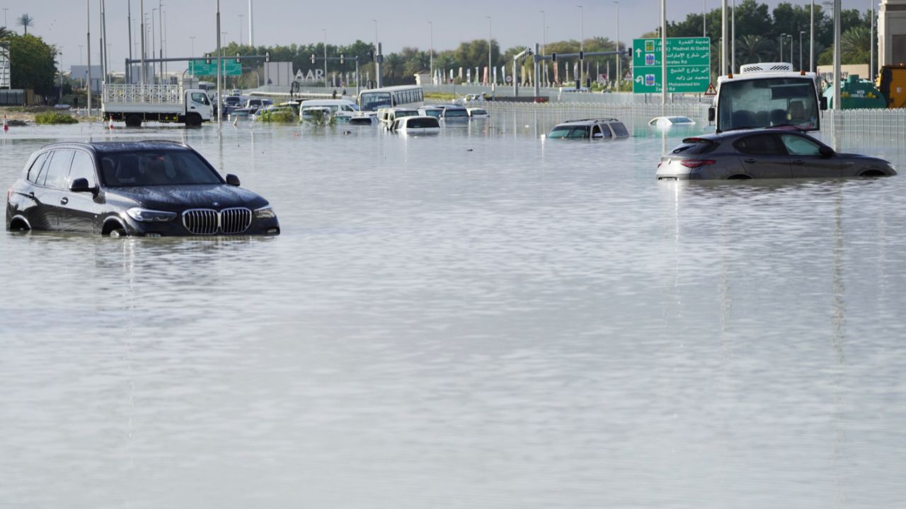
There were large areas of standing water, largely where main streets intersect with side roads. Though, by 10 p.m., water had started receding. Some of the standing water appeared to be about a foot at its deepest point. Officials caution drivers not to drive through standing water, even if it looks shallow.
The same kinds of flash flooding were also reported in neighboring Addison and Wheaton.
In south suburban Flossmoor, one resident reported the downpour flooded her backyard in just half an hour.
Suburban volunteers prepare severe weather kits

Volunteers with the Salvation Army spent Friday building 3,000 severe weather kits to be used when disaster strikes. They contain, among other things, scrub brushes, brooms, chemicals to help clean and gloves.
"We are watching the weather closely, and we are getting ready to respond here, too. We have our canteens ready, our volunteers on standby," said Karen Hanton, emergency disaster services manager for Salvation Army Chicago.
The Naperville Fire Department is also well-prepared for the incoming storms; they were last hit by a tornado in February, and devastated by a larger one two years ago.
"Father's Day in 2021 at about 11 o'clock at night, we had a tornado come through here, and it was a severe tornado that damaged about 150 homes," Fire Chief Mark Puknaitis said. "You just never know when these things are going to go. So we want to make sure that you're prepared."
The Naperville Fire Department said they're ready to respond to any downed trees, electrical fires, or anyone stranded or trapped.
Have your cellphones handy, your emergency radios if you have them, and stay indoors while this storm blows through.
How rare are tornadoes in the Chicago area?
According to the NOAA Storm Event database, there have been approximately 61 tornadoes in Cook, DuPage, Kane, Lake, McHenry and Will counties in the last 10 years that directly led to 12 injuries.
The largest of those tornadoes was an EF-3 that struck Naperville and Woodridge on June 20, 2021.
The largest tornado to hit Cook County since 1950 was an F-4 that struck Oak Lawn and the South Side of Chicago on April, 21, 1967. It directly led to 33 deaths, 500 injuries, and an estimated $25 million in property damages. It is the deadliest tornado in Cook and the collar counties since 1950.
The largest tornado recorded in Cook and the collar counties since 1950 struck Plainfield in Will County on August 28, 1990 (F-5). It directly led to 29 deaths, 350 injuries, and an estimated $250 million in property damages.
Stay tuned to ABC7 Eyewitness News and abc7chicago.com for the latest updates on the potentially severe weather.
Weather Alerts | Live Doppler Radar