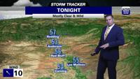


The next taste of winter in early spring arrives tonight in northern California with more valley rain, mountain snow, gusty wind and some north valley snow possible late Monday and early Tuesday.
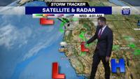
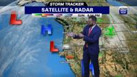
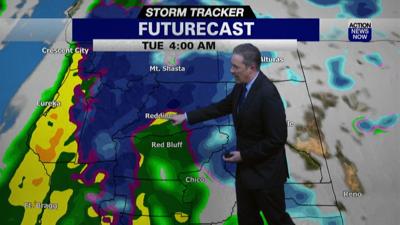
It may be spring, but another winter-like storm moved over northern California Monday. Heavier rain, stronger wind, mountain snow and some valley snow are possible. Most of this stormy weather arrives tonight and Tuesday. Some rain and mountain snow has started to fall in far northwestern parts of California already, but most of the heavy rain, heavy snow and strong wind will occur in our area between midnight tonight and early Tuesday afternoon. Wind Advisories and Winter Storm Warnings will be in effect, and the valley will also get locally heavy rain. Please drive carefully if you have to be out and about Tuesday, and driving over our mountain roads will not be safe... it may be impossible. It will be a little calmer late Tuesday.
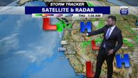
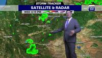
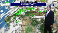
Lingering rain and snow will fall Wednesday as this storm continues on its path from north to south down the California coast. The wind won't be as strong Wednesday, but it will still be breezy. We'll have a brief break from this stormy weather pattern Thursday and early Friday with a little sunshine, less wind and slightly warmer temperatures. Another trough of low pressure will dip southward toward California this weekend and early next week, and that will lead to stronger wind from late Saturday through early Monday with better chances of additional valley rain and mountain snow, too. Temperatures will peak on Thursday, but they will still be between 5 and 10 degrees below average, with much cooler weather the other days.