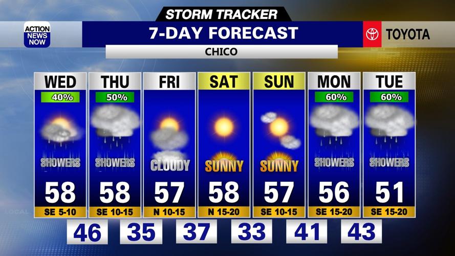

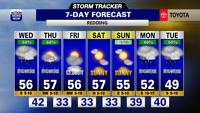

Grab your umbrella, throw on a jacket, and give yourself extra time to get where you need to go as you get ready to head out the door Wednesday. Wet weather will persist through your Thursday, but we'll dry out late this week. Frosty mornings and pleasant afternoons are on the way for your weekend.
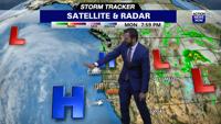
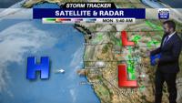
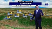
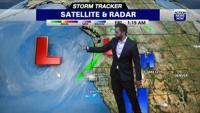
Keep your umbrella handy, throw on your jacket, and plan on giving yourself a little extra time to get where you need to go before you head out the door Wednesday. The area of low pressure that was centered off the coast of northern California on Tuesday is now centered along the coast in the Bay Area to start your Wednesday. That trough is pushing moisture north into our region, and that will drive the potential for more scattered rain and snow showers across our region through your Wednesday. Snow levels are hovering between 3500' to 4500' and some mountain travel impacts will be possible today and Thursday due to the light to moderate snowfall making our mountain roads slick. Rain totals will more than likely end up at around or under a quarter inch in the valley Wednesday. Cloudy skies and scattered showers have persisted overnight following the heavier rain and thunderstorms from Tuesday afternoon and evening. Temperatures are starting out in the 40's in the valley, 30's to 40's in the foothills, and 20's to 30's in our mountain zones early Wednesday. We'll have cloudy skies and scattered light to moderate showers today. Winds will be out of the southeast in the 10 to 15mph range, and we'll have the potential for gusts in the 20 to 25mph range. High temperatures are projected to climb into the mid to upper 50's in the valley, 40's to low 50's in the foothills, and 30's to upper 40's in our mountain zones Wednesday afternoon.
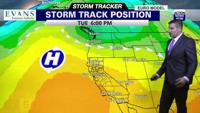
Low pressure centered to our south on Wednesday will swing east across California and end up in Nevada on Thursday while another wet system tracks into the Pacific Northwest from the eastern Pacific. We'll have the potential for more rain and snow showers across our region, and will likely have some pockets of heavier rainfall across our region Thursday. Snow levels will range from 2500' in the Northern Mountains to around 4000' in the northern Sierra on Thursday. There is a chance for some thunderstorm activity in the valley in the afternoon hours on Thursday, and the biggest threat looks to be in Tehama and Shasta Counties. Around a quarter inch of rain will be possible in the valley on Thursday. Temperatures will be very similar on Thursday to what we have on Wednesday. The trough to our north will track east from late Thursday into Friday and we'll have high pressure starting to build inland from the eastern Pacific. This will leave us with cloudy skies, but dry weather expected for your Friday. Some limited showers will still be possible in the mountains, but impacts will be minimal. We'll also have cooler overnight low temperatures for the start of your Friday, and most valley areas are projected to end up in the low to mid 30's on Friday morning. Foothill areas will start out in the 20's to mid 30's and we'll have teens to 20's early Friday in our mountain zones. High temperatures are projected to climb into the mid to upper 50's in the valley, 40's in the foothills, and 30's to 40's in our mountain areas Friday afternoon.
High pressure off the coast in the Pacific will leave us with sunny to mostly sunny skies and mostly dry weather through your weekend. Valley areas will start out in the low to mid 30's and top out in the mid to upper 50's on Saturday and Sunday. We'll have low temperatures in the 20's to 30's and high temperatures in the 40's to lower 50's in the foothills, and our mountain zones will start out in the teens to 20's and top out in the 30's to 40's this weekend. Some limited mountain showers will be possible on Sunday, but impacts should stay minimal until late Sunday night. Another wet system is projected to track south along the West Coast as we head into the start of next week, and that will bring more showers and a cooling trend back into your forecast from the start to middle of next week.